South Park lies along the west bank of the Duwamish River, five miles south of downtown Seattle. Like other communities along the river, it was first home to the Duwamish people who lived in longhouses and thrived on the bounty of the water, mainly salmon.

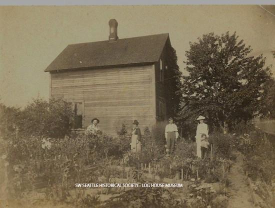
White settlers arrived in the 1850’s, including Eli Maple, the first to make a claim in South Park. He and his father cleared land and rafted logs for telegraph poles and boat poles to a ship trading with San Francisco. With the cash from the sale, they purchased two yoke of oxen and began to farm. The soil along the river was annually enriched by spring floods. Italian and then Japanese immigrants established truck farms, transporting vegetables and other produce to the Pike Place Market, some by truck and some by boat along the river.
Two Roman Catholic brothers from Belgium established a school that became Our Lady of Lourdes Church in the 1890’s. The first public school was South Park School, built about 1892, the same year the post office opened. The South Park Community Center occupies the school’s former space on 12th Ave. S. between Thistle and Sullivan. In 1889, South Park was plotted by I. William Adams and the trolley line extended from Seattle. With a population of 1500, the community voted for annexation to Seattle in 1907. A second school, Concord, opened in 1914 on Concord St. between 7th and 8th avenues.

When straightening of the Duwamish River began in 1913 and the tide flats were filled in, South Park gained 66 more acres of land, but the nature of the community began to change. Turning basins for ocean-going ships collected excess water during the spring, ending the habitual flooding. Industries grew up along the channeled river, including the Boeing Company just across the river from South Park.
During World War II, workers at Boeing and the shipyards wanted to live nearby in South Park, which created a housing shortage. The King County Housing Authority built temporary housing for war workers, the South Park Courts, which were occupied until the early 1970s, at which time they were torn down.
Industrial pressure continued, and in 1956 the area was rezoned as “transition to industrial.” When the transition seemed complete in the mid-1960’s, however, residents protested a designation as “industrial” and the neighborhood became “low-density residential.” Many Hispanic immigrants moved in, and today the neighborhood has more than 2800 residents, 13% of whom are Asian and Pacific Islander. Often feeling beleaguered by its surroundings, South Park continues to fight the encroachments of industry.


